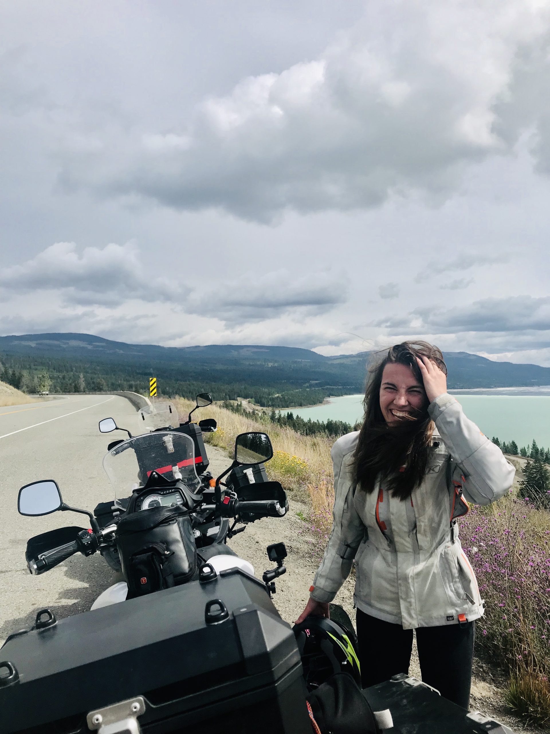


Trip Overview
Grab your pickaxe and get ready to travel back in time to the Gold Rush Days with an extended weekender through the Fraser Canyon and beyond. Begin by meandering alongside the steep, twisty rock walls of the canyon, stopping here and there for scenic blasts-from-the-past before looping through the Thompson-Okanagan countryside on your way home. On your rest day in Lillooet, you’ll be treated to panoramic views while standing atop Camelshoof Mountain—aptly named after 23 Camels that were brought to the area during the 1800s.
Arrrre yeeeh ready?! Let’s go!
The Route
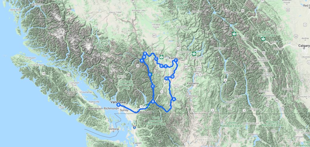
Check out the full map on Google Maps, here.
Suggested Itinerary
Day One: Vancouver to Seton Lake Campground, Lillooet | 328 KM
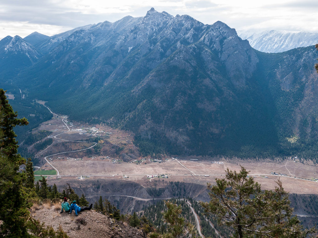
Day Two: Seton Lake Campground to Camelshoof Peak (and back) | 53 KM
Day Three: Seton Lake to Dewdney Recreation Site, Princeton | 413 KM
Day Four: Princeton to Vancouver | 291 KM
Route Highlights
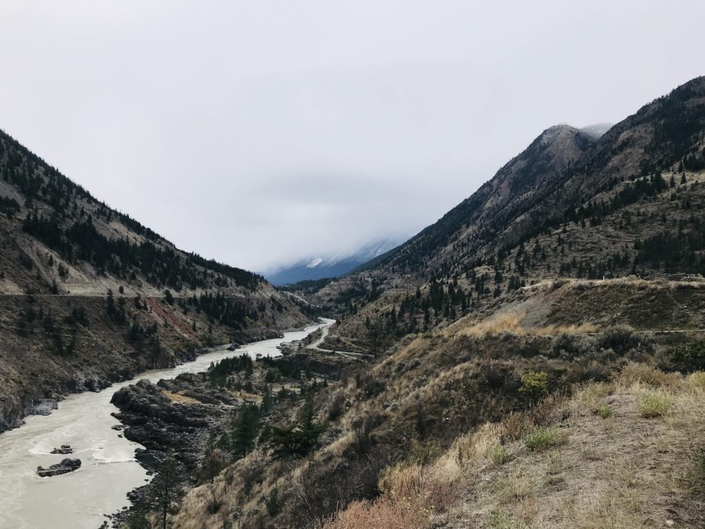
Highway 1: The Fraser Canyon. Twist along highway that’s been carefully carved into the steep rock walls of the Fraser Canyon. The canyon’s desert-esque feel, train bridges, trestles, and tunnels, and visible lava flows from the Pliocene period are like a time machine that take you straight back to the canyon’s 1850’s claim to fame: the Fraser Canyon Gold Rush. Keep your eyes peeled for sights galore and don’t forget to stop at Hell’s Gate which towers 1,000 M above the rapids below.
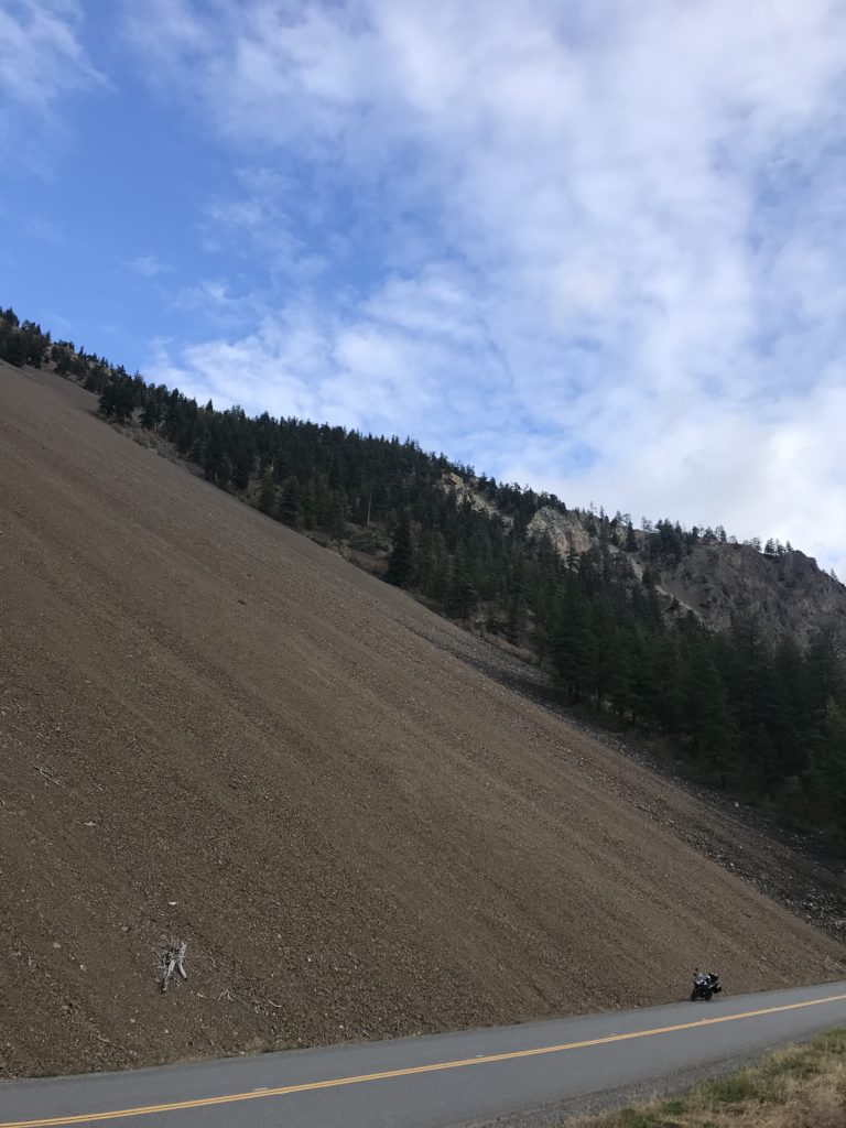
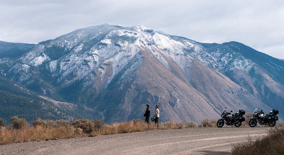
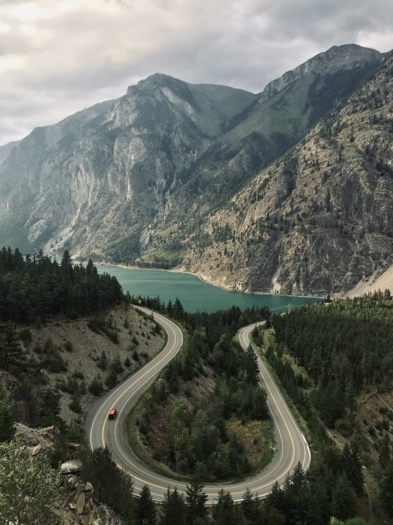
Highway 12: Lytton-Lillooet Highway. Exiting Lytton, you’ll be treated to some of the most scenic views of the trip as you head toward Lillooet. Think: mountain-high scree, lush acreage, smooth curves, and a two-sometimes-one lane highway lit up in the golden glow of the afternoon sun. And don’t forget to hold onto your hat when you reach the stretch just south of Lillooet, where the road gets a little narrower, the cliff a little steeper, and the rocks a little looser.
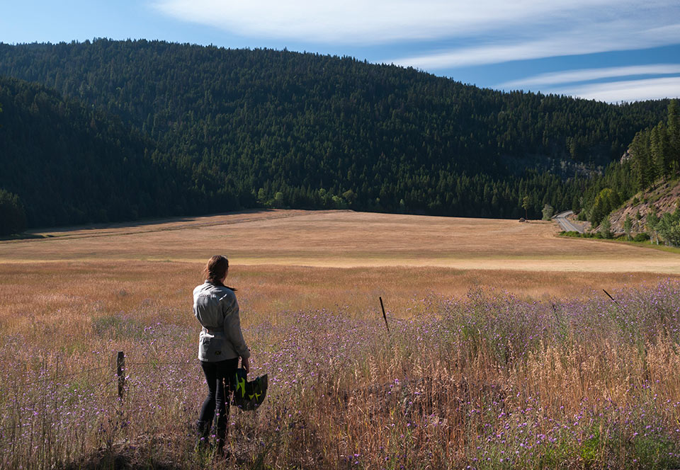
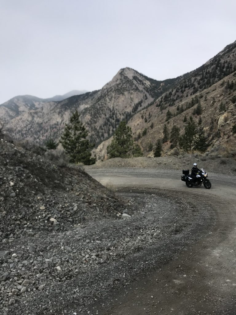
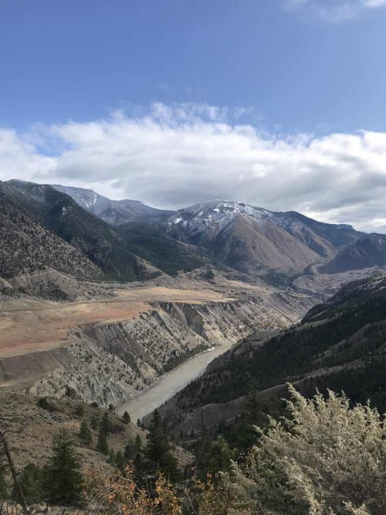
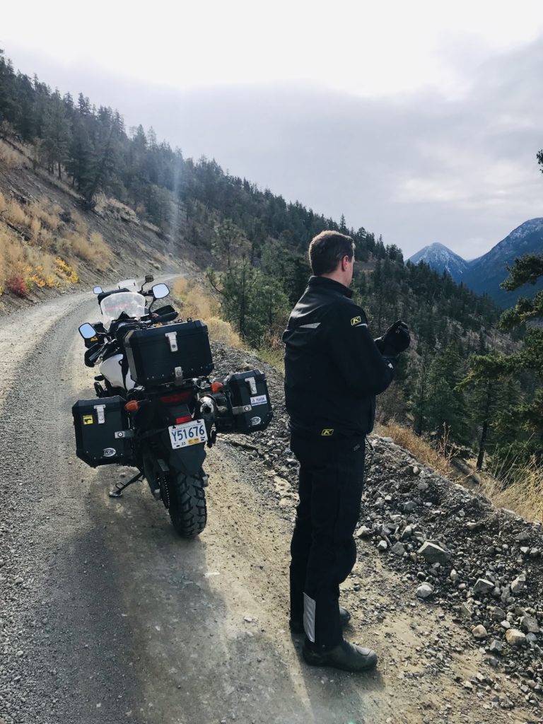
West Pavilion Forest Service Road. This is the dirty stuff and we can’t get enough of it! Meandering along the much-less-travelled side of the Fraser River, West Pavillion FSR to Camelshoof Peak is a not-to-miss day ride detour from Lillooet. Slow down as you pass the junction of Bridge River Road and West Pavilion Road–There’s a pullout that treats you to views of the Bridge River Rapids and some of the narrowest sections of the Fraser River. Keep winding your way up the switchbacks until you find the trailhead to Camelshoof Lookout. Finish up your hike early? Continue on down the West Pavilion FSR a few more KMs for some epic views of the surrounding area.
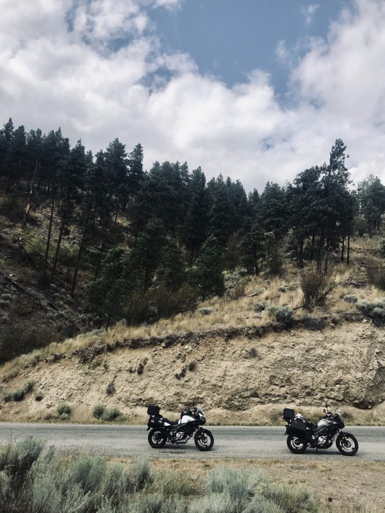
Highway 5A: Kamloops to Merritt; Merritt to Princeton. The road less travelled, extending all the way from Kamloops to Merritt to Princeton. This lightly trafficked, two-lane highway weaves through Okanagan backcountry. North of Merritt, you’ll be surrounded by grassy, rolling hills. South of Merritt, you’ll move through tree and lake-filled valleys. There’s something uniquely tranquil about this section—maybe its the long curvy turns, the break from heavy highway traffic, or that one field with the massive, lonesome tree–who knows. It’s definitely worth the ride.
Highway 3: Crowsnest Highway. This highway hugs the southern border of the Province and beyond, extending over 1,100 KM from Hope, BC to Canmore, AB. Get ready for some post-card-perfect mountain valley views, hairpin turns as you leave Princeton, and BC Provincial Park beauty as you move through EC Manning Provincial Park.
Places To Stay
BC Hydro Seton Lake Dam Campground, Lillooet. Did you know that BC Hydro has six recreation sites across BC that provide free camping on a first-come, first-serve basis? The purpose of these sites is to allow BC’ers to use outdoor spaces developed by BC Hydro “in a way that protects the environment and still supports power generation”. The Seton Lake Dam Campground near Lillooet—open May 1 to October 31—is one of these. For details and full amenities, click here.
Dewdney Recreation Campsite REC 1633, Princeton. Just barely off of Old Hedley Road you’ll find this 6-spot, first-come-first serve, free campsite to pitch your tent. It’s a little bit noisy with the Highway so close, but a relatively okay place to rest your head for the evening. The convenience of this campsite brings in all types of characters and excitement—one time we were even fortunate enough to meet a yappy chihuahua donned in full-on camo, what a sight! If roughin’ it here isn’t your thing, it’s not too far to head into Princeton and stay in a motel or hotel.
Things To See, Eat, & Do
By “See” I mean, a quick stop. By “Do” I mean, it’s likely a few hours. By “Eat” I mean, well, eat!
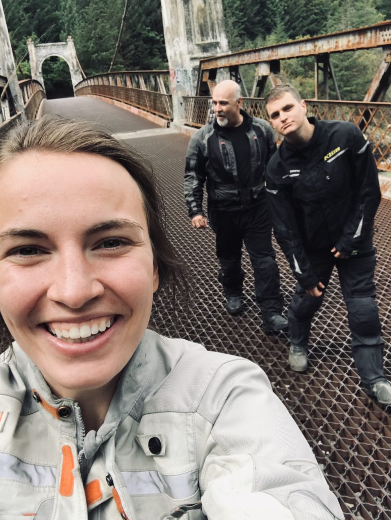
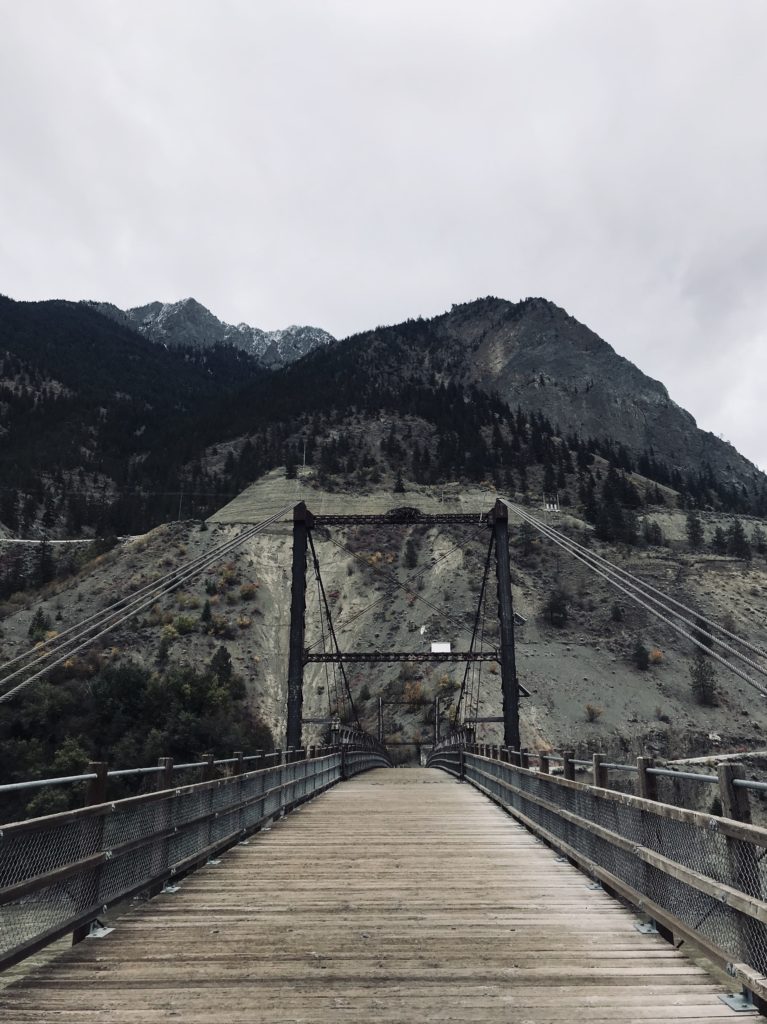
SEE: Alexandra Bridge Provincial Park. Take a short, 2KM jaunt off Highway 1 near Spuzzum to see the almost 100-year-old Alexandra Suspension Bridge in Alexandra Bridge Provincial Park. The original Alexandra Bridge (built in the 1860’s and replaced in the 1920’s by the structure you’ll see today) was part of the world-famous “Cariboo Wagon Road” which extended all the way from Fort Yale to Barkerville. The stone footings on today’s bridge are still the originals, from 1863. Trail details can be found here.
SEE: The Original Hell’s Gate Tunnel. You’ll move through 7 tunnels in the Fraser Canyon, where the highway winds through the mountains instead of around them. Keep your eyes peeled after the Alexandra Tunnel. Pull off the highway and onto the shoulder at the foot of the Hell’s Gate Tunnel and hike a couple minutes to the left of the highway, you’ll find the remains of the Original Hell’s Gate Tunnel, which you can still walk through.
DO: Hell’s Gate Airtram. A classic tourist trap, but you’ve gotta do it once! The airtram descends across “Hell’s Gate”—a 35M wide passage in the Fraser Canyon characterized by the explorer Simon Fraser in 1808 as “a place where no human should venture, for surely these are the gates of Hell.” At the bottom of the airtram, you can also get a closer look at the river by walking across the Hell’s Gate Suspension Bridge.
EAT: Old Towne Inne, Boston Bar. Yeeeeeeeehaw! You’ll start feeling a little wild-wild-west as soon as you step foot into this saloon-themed bistro in Boston Bar. Fill your belly with one of the 21-types of burgers or maybe chow down on a pizza, fish and chips, or pasta. And if it’s a chillier day in the Fraser Canyon, it’s hard to beat the self-serve, all-you-can-eat soup station—there’s nothing quite as comforting as a bowl of potato, leek, bacon chowder with a thick slab of buttery garlic toast.
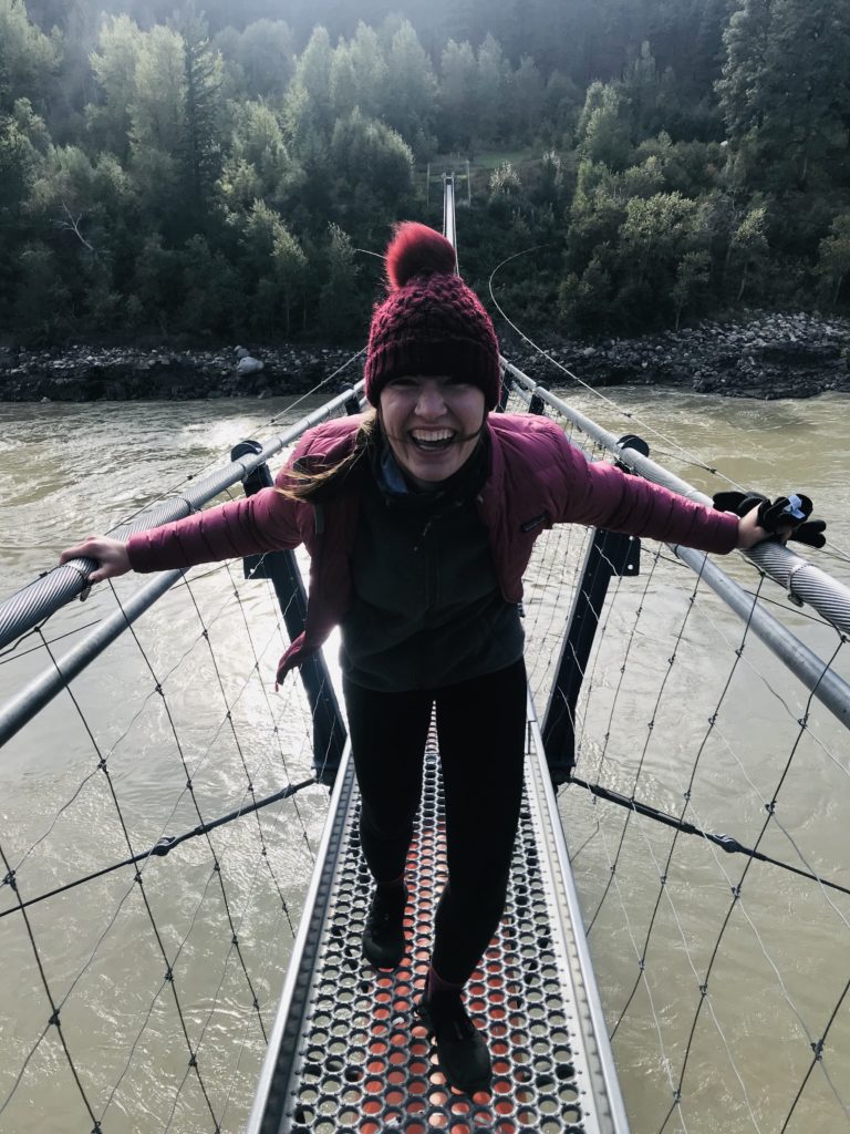
SEE: The Lytton Catwalk. Lytton, BC is one of the oldest, “continuously-settled communities in North America”. It’s also known as the River Rafting Capital of Canada. No time for a full river rafting adventure? No Problem. Head down to the end of River Drive for a short stop and walk across the Lytton Catwalk. Built beside the railway bridge, this pedestrian bridge gives a birds-eye view of the confluence of the Fraser and Thompson Rivers.
SEE: Kenny Glascow’s, Lytton. You’ll know you’re at Kenny’s place when you see a gate with a 60ft replica of a Winchester Rifle balanced on top of it. An artist for over 14 years, Kenny has turned his property into his personal art installation, which melds together larger-than-life recycled art with pensive quibbles from his journals. Kenny embraces visitors on his property at any time: “Welcome to my debris of independence, the remaining parts of my thrown away youth, my hovel of broken accomplishments, my plans of yesterdays failures, my wreckage of shattered dreams, my promises of great returns. Yes, come in. We can cry over yours as well, for it is only human to share.” It’s definitely an eclectic off-the-beaten-path attraction that is worth a wander.
DO: Fraser River Suspension Bridge. Ten minutes north of Lytton, just a smidgen past the Recycling Transfer Station, you’ll notice a gate with a pullout, on the left side of the road. Park your bike here and hike down the road for about 20 minutes. As you reach the river, you’ll come across the Fraser River Suspension Bridge. And if you’re in for a little longer leg stretch, the trail on the other side of the bridge will take you to the Stein Valley Nlaka’pamux Heritage Park and Stein River Valley.
DO: The Lookout Near Camelshoof Peak. This is what it’s all about!!! Pack a lunch, hop onto your adventure bike, and take a day trip from Lillooet to Camelfoot Mountain. Starting from Lillooet, drive north on Bridge River Road. Once you pass over the bridge, hang a tight right onto West Pavillion Road. It’s all dirt from here—and not for the faint of heart! Follow the road for approximately 10km, until you are past the switchbacks at the base of Camelfoot Mountain. Keep an eye out on your left side for a grass-covered, decommissioned road that switchbacks up the mountain. When you see it, park your bike and start hiking. You can find the trail map on All Trails here. If you have enough time and your legs are feeling fresh, keep climbing past the lookout shown on the map. You’ll eventually end up at an old Forestry Fire Lookout structure, with 360-degree views of the neighbouring mountains. Read more about the peak here, including why it was named after Camels!
SEE: Highland Valley Copper Mine. As you ride along Highway 97C, you’ll come across Highland Valley Copper Mine. This is the largest open pit copper mine in Canada, and in present day, combines three historic mining operations: Bethlehem, Lornex, and Highmount. Back in the 1970s, my Grandpa used to work at the Bethlehem Minecas we passed the mine on our trip, my Dad recalled that he and my Grandma drove all the way up the canyon to pick up my Grandpa from the mine, when it was time to come home. What’s all that white stuff, you ask? Although from a distance it resembles a beach-y paradise, that “white stuff” is tailings, which is the waste from the mining process. Curious about tailings? You can explore more here. As you take a rest and check out the mine from the view point, watch the quarry steps closely. you’ll be able to see Mining Trucks hard at work—from your vantage point, they’ll look like hotwheels, but up close they are mega-machines! (There’s a full-sized one that you can check out as you pass through Logan Lake!).
SEE: Cascade Lookout, Manning Park. As you approach the Manning Park Resort, dip off the highway on the right-hand-side and head up to the Cascade Lookout. It’s the perfect spot for a leg stretch and view of Southern BC mountains and (if it’s a clear day!) you’ll also be treated to views that extend into the USA. If you’ve got an extra day available and are craving some backcountry trail running or hiking, this is a great place to use it. Just past the Cascade Lookout is the trailhead to the Three Brothers Trail or, you can head back across the highway to Lightning Lakes and choose from a variety of trails, including Frosty Mountain, Windy Joe, and East Skyline.
SEE: The Hope Slide Viewpoint. A short detour between Sunshine Valley and Hope, is where you can find the viewpoint for the Hope Slide—the second largest landslide in Canada. Two earthquakes in 1965 brought down 47 million cubic metres of debris into the valley and claimed four lives. Take a break here to look at the carved-out mountainside where the debris originated and read through the information panels, which share more about other tragedies that have occurred in the valley as well.